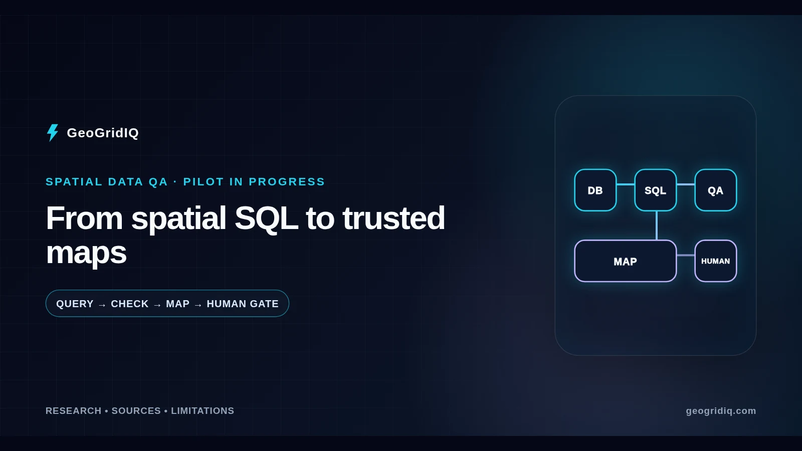
The problem
Why geography can fail even when a query runs
Database success is a narrow result: the syntax parsed, the referenced objects existed, and the engine returned rows. It does not establish that a coordinate reference system was interpreted correctly, that a municipality identifier joined to the intended region, or that a point represents anything more than a location. PostGIS distinguishes planar geometry from geodetic geography, and measurements inherit those choices. A query can therefore be computationally valid while its real-world meaning is wrong. Sources: PostGIS Project (opens in a new tab) PostGIS Project (opens in a new tab)
Coastlines and coverage gaps make the problem especially visible. A partial coastal cell can be classified as entirely land, a water-only cell can inherit nearby evidence, overlaps can double-count area, and missing coverage can be silently converted to zero. Generalized boundaries or mixed source vintages add different failure modes. If location, coverage, time, or geometry is wrong, an upstream feature, evaluation set, or interpretation may be contaminated before a model sees it; that does not mean every defect changes a forecast. Source: PostGIS Project (opens in a new tab)
Evidence: Conceptual Illustration
Why matching row counts are not enough
A conceptual comparison shows how identical counts can conceal displaced geometry and why both numeric and visual controls are needed.
Scroll horizontally or use the arrow keys to compare every column.
| Review signal | Plausible but wrong | Corrected evidence state |
|---|---|---|
| Row count | 240 rows returned | 240 rows returned |
| Map position | Grid appears shifted beyond the reviewed boundary | Grid aligns after CRS transformation review |
| Required control | Inspect SRID, extent, and control locations | Record transformation and rerun measures |
| Decision | Hold as unresolved evidence | Eligible for independent review—not automatically accepted |
Conceptual illustration with invented counts; it is not GeoGridIQ pilot or production output.
Terminology
What GeoSQL is—and what it is not
Here, GeoSQL means the open-source agent skill maintained in the dekart-xyz/geosql project. Its documented workflow helps an agent discover metadata, write engine-aware spatial SQL, consider query cost, validate quantities and geometry, and optionally use a Dekart-rendered map for feedback. The project documents PostGIS alongside other supported platforms. GeoGridIQ has installed package metadata version 0.31.0 in an isolated profile, but installation is not evidence that the full workflow has run. Sources: Dekart XYZ (opens in a new tab) Dekart XYZ (opens in a new tab) GeoGridIQ
GeoSQL is neither a source of authoritative geography nor a replacement for PostGIS, GIS expertise, or operational review. Dekart is the optional analysis-map harness; it is not GeoGridIQ’s customer-facing map. MapLibre remains a separate product visualization concern. Most importantly, GeoSQL is not an outage model, a service-territory authority, an autonomous production writer, or permission to bypass licences, privacy, temporal lineage, and approval. It accelerates work that qualified people still have to examine. Sources: Dekart XYZ (opens in a new tab) Dekart (opens in a new tab)
System boundary
GeoGridIQ’s existing spatial foundation remains authoritative
The pilot is being designed beside GeoGridIQ’s existing spatial and model-governance controls, not as a replacement layer. PostgreSQL/PostGIS can store and query points, lines, polygons, and spatial indexes; GeoGridIQ’s governed workflow separately tracks the role and time of inputs, regional eligibility, and model-release status. A geometry that is useful for display is not automatically suitable for measurement, training, or a legal-territory claim. Sources: PostGIS Project (opens in a new tab) GeoGridIQ
That separation also protects the public product. A temporary QA map may show simplified, sanitized, or intentionally synthetic geometry so reviewers can find defects. It must not be presented as a live risk surface or silently flow into product mapping. Likewise, improving an upstream spatial evidence package does not reactivate a suspended model, certify a forecast horizon, or publish a prediction. The downstream prediction pipeline keeps its own eligibility, temporal-safety, evaluation, and promotion gates. Source: GeoGridIQ Continue: How outage prediction works Why forecast accountability matters
Proposed controlled loop
The map-in-the-loop workflow
A controlled run begins with an official or otherwise governed source contract: role, licence, retrieval date, version, URL, and checksum. A reviewed copy is loaded into isolated staging, where the actual schema and coordinate reference system are inspected before SQL is written. Bounded predicates and spatial indexes can reduce candidate pairs before exact spatial tests, while counts, area, length, extent, validity, duplicates, and coverage provide independent numerical signals. Sources: PostGIS Project (opens in a new tab) Dekart XYZ (opens in a new tab)
The same result is then rendered as a review map. A person checks known regions, boundaries, coastlines, exceptions, and event clusters; corrections become versioned transformations rather than undocumented edits. The query and measurements run again, and the package records SQL identity, source identity, metrics, maps, limitations, and unresolved cases. A plausible map cannot replace numerical tests, and clean metrics cannot replace geographic inspection. Both signals must agree before independent governance can consider the evidence. Sources: Dekart XYZ (opens in a new tab) Dekart (opens in a new tab)
Evidence: Conceptual Illustration
A bounded map-in-the-loop review
Each iteration pairs reproducible measurements with map inspection, then stops at a human checkpoint before evidence leaves staging.
-
01
Discover
Inspect real schema, types, source role, and CRS.
-
02
Query
Write bounded, index-aware spatial SQL.
-
03
Measure
Check count, area, length, extent, validity, and coverage.
-
04
Render
Build a local or self-hosted analysis map.
-
05
Inspect
Review coastlines, boundaries, exceptions, and anomalies.
-
06
Correct
Version the transformation and rerun both checks.
-
Gate
Human review
Package, reject, or return unresolved evidence.
Conceptual workflow based on official tool documentation; GeoGridIQ has not completed this end-to-end pilot loop.
Figure sources: Dekart XYZ (opens in a new tab) PostGIS Project (2026-06-08) (opens in a new tab) Dekart (opens in a new tab)
Initial review scope
What we are testing first
The first planned controlled workflow focuses on Quebec grid and serviced-land evidence QA. It asks which reviewed cells are wholly or partly inside the governed geography; which portions are land, mixed land and water, open water, or unavailable; and where reviewed distribution-presence evidence or documented exceptions exist. It also asks whether verified historical event points map to expected cells without treating a point as a territory polygon. Source: GeoGridIQ
This is a prepared test scope, not a completed result. Source-registry and map definitions exist, but the staging run, database validation artifacts, map renders, reviewer decisions, and governed handoff package are absent as of July 29, 2026. Accordingly, this article publishes no whole-cell or partial-cell result counts and makes no official service-territory assertion. Future results should distinguish complete, partial, contradictory, unavailable, and manual-review evidence instead of collapsing unknown coverage into zero. Source: GeoGridIQ
Conceptual examples
Mistakes a map can help expose
A coordinate reference system error can displace features offshore even while row counts remain stable. Confusing ST_SetSRID with ST_Transform is one concrete route to that failure: one assigns a reference-system identifier, while the other changes coordinates. A wrong join key can place the expected number of records in unrelated cells. In both cases, the map supplies an anomaly signal, not a diagnosis; the reviewer must inspect the transformation, identifiers, extents, and known control locations. Sources: PostGIS Project (opens in a new tab) PostGIS Project (opens in a new tab)
Other mistakes are semantic. A coastal cell can be forced into a single land-or-water category when it should remain partial. A municipality or distributor point can be expanded into an unsupported service polygon. Structural validity checks may accept a well-formed polygon that represents the wrong concept. The examples below are original conceptual mini-maps, not before-and-after production data; each pairs the visible clue with the additional control needed before changing an evidence state. Source: PostGIS Project (opens in a new tab)
Evidence: Conceptual Illustration
Four errors that can survive a successful query
Each conceptual card pairs a misleading numerical signal with a map clue and the control needed to resolve it.
- CRS mismatch Count looks stable; features shift
- Check SRID, transform, extent, and reviewed control locations.
- Wrong join key Row total looks plausible; cells are unrelated
- Audit key uniqueness, unmatched rows, and known-region samples.
- Partial coastal cell One category hides mixed coverage
- Measure intersections and preserve partial or unavailable states.
- Point as territory A location becomes an unsupported area
- Keep evidence roles distinct; require an authoritative territory source.
Original conceptual examples; no card represents GeoGridIQ production data or a completed pilot result.
Figure sources: PostGIS Project (2026-06-08) (opens in a new tab) PostGIS Project (2026-06-08) (opens in a new tab)
No direct write
How evidence moves toward outage intelligence
The exploration zone can discover a source, stage a reviewed copy, write SQL, measure coverage, render a map, and document unresolved findings. It cannot confer authority. A human gate separates that work from the governed application zone, where reviewers decide whether the source role is acceptable, geometry and coverage are fit for a stated use, and a candidate feature is eligible. The pilot has no direct write path into GeoGridIQ production data. Source: GeoGridIQ
If evidence survives that review, separate processes still test temporal leakage, model behaviour, and promotion criteria before trusted predictions could be generated. GeoSQL does not create positive or negative outage labels, select cells for training, train or promote a model, save risk, or release a public forecast. This boundary matters because faster investigation should not become faster propagation of an unsupported geographic assumption. Sources: GeoGridIQ GeoGridIQ Continue: Forecast accountability and temporal safety
Evidence: Conceptual Illustration
The human gate between exploration and application
The pilot can prepare evidence, but only independent review can allow an accepted input to enter later feature and model processes.
-
QA
Explore
Discover sources and inspect schemas.
-
QA
Stage + validate
Run SQL, measures, maps, and document unknowns.
-
STOP
Human approval gate
No direct write; accept, reject, or return evidence.
-
Governed
Source + feature review
Check authority, coverage, eligibility, and temporal safety.
-
Separate
Model evaluation
Training, testing, and promotion use their own controls.
-
Conditional
Prediction release
Only a separately trusted, approved process may publish.
Conceptual governance boundary. The installed pilot has not produced or handed off an accepted evidence package.
Figure sources: GeoGridIQ (2026-07-29) GeoGridIQ
Status, not promises
How GeoGridIQ may expand the workflow
Current foundation, pilot work, planned uses, and prohibited actions must not be blended into one product claim. The current foundation includes spatial querying and existing governance controls. The installed GeoSQL profile and configured map-QA design remain under evaluation. A self-hosted Dekart stage is planned in the pilot design but has not completed runtime validation, so it is not described as operational. Sources: GeoGridIQ Dekart (opens in a new tab)
Subject to source, licence, privacy, and validation review, later work may cover municipal or cooperative exceptions, ECCC forecast-grid mapping, vegetation-source provenance, static exposure context, historical-event geometry, future grid design, Canada-wide gap analysis, and repeatable regression maps after source updates. These are planned investigations without delivery dates. Production labels, automated training or promotion, dispatch, cause determination, direct data mutation, and ungated forecast release remain outside the workflow. Source: GeoGridIQ Continue: NDVI and utility vegetation monitoring Understanding critical infrastructure risk
Evidence: Planned Capability
Current, pilot, planned, and not-authorized capabilities
A semantic status table prevents configured or proposed work from being read as a live production capability.
Scroll horizontally or use the arrow keys to compare every column.
| Capability | Verified status | Meaning as of July 29, 2026 |
|---|---|---|
| PostGIS spatial queries | Current foundation | Existing spatial capability; not created by GeoSQL |
| Isolated GeoSQL profile | Pilot / installed | Version 0.31.0 installed; end-to-end workflow incomplete |
| Map feedback through self-hosted Dekart | Pilot / configured | Planned stage has not completed runtime validation |
| Quebec grid and serviced-land QA | Pilot / prepared | Review questions defined; no accepted result package |
| Weather-grid, vegetation, exposure, and event QA | Planned | Subject to source, privacy, licence, and validation review |
| Production labels, training, promotion, and release | Not authorized | Always governed through separate processes |
Status grid generated from the July 29, 2026 claim review; no delivery dates or pilot results are implied.
Figure sources: GeoGridIQ (2026-07-29) GeoGridIQ
Controlled pilot principles
Security, privacy, and controlled access
The public design principle is isolation. Local or self-hosted tooling is preferred for the controlled pilot; any applicable application access is intended to be read-only, and allowed writes belong only in isolated staging. Official Dekart guidance also recommends a dedicated read-only database user and TLS, but those controls depend on deployment configuration. GeoGridIQ’s runtime denial probes have not yet run, so this article describes intended restrictions rather than claiming runtime proof. Sources: Dekart (opens in a new tab) Dekart (opens in a new tab) GeoGridIQ
Credentials must not be embedded in content or maps. Customer addresses, crew locations, billing and authentication data, private identifiers, and sensitive infrastructure locations are outside the public article workflow. Rendering a map does not authorize sharing it; source licences and permitted uses require review, and any external data transfer needs a separate decision. GeoSQL’s documented telemetry opt-out is relevant configuration information, not proof that every connected workflow has zero external transfer or zero risk. Sources: Dekart XYZ (opens in a new tab) GeoGridIQ
Limits
What this workflow cannot prove
Visual plausibility is not correctness. A valid geometry can represent the wrong concept; infrastructure presence is not legal service territory; and a municipality boundary is not automatically a utility boundary. Even an official source can be incomplete, generalized, stale, or unsuitable for a new role. A map can reveal displacement or surprising coverage, but it cannot establish licence, authority, completeness, or temporal fitness on its own. Source: PostGIS Project (opens in a new tab)
The reverse is also true: numerical tests do not replace a map. Neither form of QA establishes forecast accuracy, guarantees that an outage will be predicted or prevented, or proves an operational benefit. The GeoSQL pilot is one upstream evidence-control experiment. Human review, documented limitations, independent governance, and downstream model evaluation remain required even if the workflow later becomes repeatable. Sources: GeoGridIQ GeoGridIQ
Operational relevance
Practical value for utility operations
The credible value is procedural rather than a promised return on investment. Schema-aware exploration can reduce time spent guessing field names; versioned spatial SQL can make joins easier to reproduce; and paired metrics and maps can surface geometry or coverage defects earlier. Reviewers can see which cells remain contradictory or unavailable instead of receiving a single opaque output. Before-and-after maps can also make a source update easier to explain. Source: Dekart XYZ (opens in a new tab)
A shared evidence package gives GIS, data engineering, machine-learning, and operations specialists a concrete object to challenge: the source contract, query, measurements, map, limitations, and unresolved cases. That can improve technical communication and provenance before any feature reaches a model. GeoGridIQ is not claiming percentage savings, forecast improvement, reduced restoration time, or outage prevention; such claims would require a measured, reviewed deployment study that does not yet exist. Source: GeoGridIQ
Conclusion
Faster investigation is useful only when evidence stays reviewable
GeoSQL may help GeoGridIQ move more efficiently through spatial investigation, but the objective is not to let an agent decide what the grid means. The objective is to combine source contracts, reproducible SQL, numerical validation, accessible maps, provenance, and human judgment. The installation is a starting point; the staging run, map review, permission checks, evidence packaging, and independent acceptance still have to be completed and documented. Source: GeoGridIQ
If those gates work as intended, better spatial evidence may move safely toward GeoGridIQ’s wider outage-intelligence workflow. If a source role, transformation, map, or permission boundary fails review, the evidence should stop. That fail-closed outcome is part of trustworthy data engineering—not a failed forecast. Source: GeoGridIQ Continue: Explore the GeoGridIQ Knowledge Hub
Frequently asked questions
Questions this article answers
What is GeoSQL?
GeoSQL is an open-source agent skill for geospatial data work. It can guide schema discovery, spatial SQL, numerical and geometry checks, and optional map feedback across documented platforms including PostGIS; its output still requires qualified review.
Is GeoSQL the model that predicts power outages?
No, GeoSQL is not GeoGridIQ’s outage-prediction model. It is being tested as an upstream spatial data-engineering and QA assistant with no authority to create labels, train or promote models, save risk, or publish forecasts.
Why does GeoGridIQ need a map if the SQL query already ran?
GeoGridIQ needs a map because a successful query can still return geographically implausible results. Visual review can expose displacement, wrong joins, coastal classification errors, overlaps, or unsupported evidence roles that row counts alone may hide.
Does GeoSQL write to GeoGridIQ’s production database?
No, the GeoSQL pilot has no authority to write to GeoGridIQ’s production database. Its design limits permitted writes to isolated staging, and runtime permission probes still need to be executed before that restriction can be described as runtime-validated.
How is GeoGridIQ using GeoSQL today?
Today, GeoGridIQ has installed GeoSQL 0.31.0 in an isolated project profile and prepared a controlled map-QA pilot. Staging, numerical validation, Dekart rendering, permission probes, and governed evidence handoff have not yet produced verified results.
What does GeoGridIQ plan to use GeoSQL for next?
Next, GeoGridIQ plans to validate the controlled Quebec workflow before considering broader uses. Possible later work includes weather-grid mapping, vegetation provenance, exposure context, historical-event geometry, and source-gap analysis, each subject to review.
Can GeoSQL determine an electric utility’s official service territory?
No, GeoSQL cannot determine an electric utility’s official service territory by itself. It can help query and compare reviewed evidence, but only a source authoritative for that legal or operational role can support a territory claim.
Does map-in-the-loop validation guarantee the data is correct?
No, map-in-the-loop validation does not guarantee that data is correct. A plausible map may use the wrong concept or stale source, while numerical tests can miss geographic anomalies; source review, both forms of QA, and human judgment remain necessary.
What happens after GeoSQL produces an evidence package?
After GeoSQL produces an evidence package, independent governance must accept, reject, or return it for more work. Accepted evidence still faces source-role, geometry, coverage, feature-eligibility, temporal-safety, model-evaluation, and release gates.
Evidence register
Sources
Sources were reviewed on . Mutable sources are rechecked on the article review schedule.
-
GGI_GEOSQL_STATUS GeoGridIQ. GeoSQL pilot status and governance audit. 2026-07-29.
-
GGI_MODEL_STATUS GeoGridIQ. Protected-artifact safety and runtime availability audit.
-
GEOSQL_REPO Dekart XYZ. GeoSQL repository and workflow documentation (opens in a new tab).
-
GEOSQL_METADATA Dekart XYZ. GeoSQL project metadata (opens in a new tab). 0.31.0 metadata reviewed 2026-07-29.
-
GEOSQL_LICENSE Dekart XYZ. GeoSQL MIT License (opens in a new tab). 2026.
-
DEKART_REPO Dekart. Dekart repository and SQL-map documentation (opens in a new tab).
-
DEKART_DOCKER Dekart. Docker self-hosting guide (opens in a new tab).
-
DEKART_POSTGRES Dekart. Postgres and PostGIS connection guide (opens in a new tab).
-
DEKART_LICENSE Dekart. Dekart self-hosted editions and licensing (opens in a new tab).
-
POSTGIS_DATA_MODEL PostGIS Project. PostGIS 3.6 spatial data management (opens in a new tab). 2026-06-08.
-
POSTGIS_QUERIES PostGIS Project. PostGIS 3.6 spatial queries (opens in a new tab). 2026-06-08.
-
POSTGIS_VALIDITY PostGIS Project. ST_IsValid (opens in a new tab). 2026-06-08.
-
POSTGIS_TRANSFORM PostGIS Project. ST_Transform (opens in a new tab). 2026-06-08.